
Frankfort ZIP Directory Coverage
Frankfort ZIP code research has one firm starting point: 60423 is the verified primary ZIP for the Village. Village Hall, Frankfort Public Library, Frankfort Township, the Frankfort Area Historical Society, and the local post office all use it. That agreement makes 60423 useful for sorting records, but it does not prove that every address bearing “Frankfort” is inside the incorporated Village. Postal service, municipal government, and township government draw different lines.
| ZIP Code | Areas Covered | Post Office | Notes |
|---|---|---|---|
| 60423 | Verified Frankfort mailing area, including Village and Township addresses | Frankfort Post Office, 21201 S Elsner Road | Primary verified ZIP; legal municipality still requires a parcel or boundary check |
| Nearby ZIPs | Not assigned here without an exact-address result | Confirm through USPS | No second ZIP was firmly tied to the incorporated Village in the reviewed response |
The Frankfort Post Office listing gives the local station, telephone number, and counter hours. USPS also maintains lookup modes for an exact street address, a city and state, or cities associated with a ZIP. Use the exact-address mode when a parcel lies near a boundary. A regional list or a nearby town’s ZIP is not enough evidence to expand a Frankfort ZIP code directory.
Verify a Frankfort ZIP Address
Postal validation should come before a public-record search. Enter the company only when relevant, then supply the street, unit, city, and state in the USPS ZIP Code Lookup. Copy the standardized result as returned. The recognized city name is a mailing label, not a finding about Village limits, county jurisdiction, or who occupies the site.
- Search the full address, including any apartment or suite.
- Record the standardized city, state, ZIP, and ZIP+4.
- Run the county address search to obtain the parcel context.
- Check the Village, township, and county layers separately.
This order prevents a common error: treating the word Frankfort in a mailing address as proof that Village offices hold every related record. It also keeps a ZIP-wide search from drifting into Mokena, New Lenox, Tinley Park, or another nearby place without official support.
Inside Frankfort ZIP 60423
The USPS station page is the source for the local postal counter shown below.
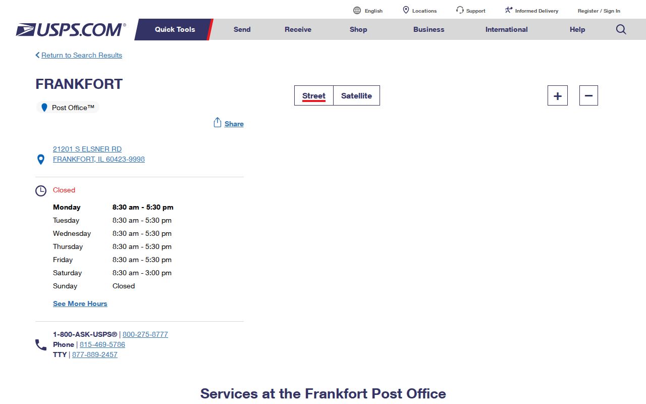
The station record confirms a real 60423 service point. It does not define the outer edge of the delivery area, list households, or settle whether any one address falls inside the Village. Keep the image tied to postal access only.
Find Frankfort Residents by ZIP
A Frankfort ZIP code can narrow a known-person search, but official systems use it in different ways. The state voter tool accepts a five-digit ZIP with a first name, last name, and birth date to confirm one registration. It does not publish an open ZIP roster. The county parcel service exposes a ZIP field with address and PIN data, while the assessor screens begin with an address, owner name, subdivision, sale, class, or parcel number.
- Confirm the exact postal form and five-digit ZIP with USPS.
- Use the Will County address search to locate the parcel and city/town field.
- Review the GIS parcel and boundary layers, noting their publication date.
- Use the Illinois voter lookup only to confirm a known person with all required inputs.
Once 60423 has narrowed the place, switch to a precise street address. The Frankfort street directory explains the full address and parcel trail. That is more reliable than trying to turn one postal zone into a list of current occupants.
Frankfort ZIP Search Fields
Each official tool asks a different question. The following fields show why a ZIP code directory must separate postal confirmation, parcel location, and voter confirmation. A missing ZIP box does not make a tool less useful; the county address search can normalize a site before the parcel record supplies its ZIP.
| Official tool | Fields used | What it can confirm |
|---|---|---|
| USPS lookup | Street, unit, city, state, ZIP | Recognized mailing form and postal code |
| County Address Search | Street number, street name, city/town | County-maintained address match |
| Township Assessor | PIN, street number, direction, street name, city | Assessment parcel lead |
| Illinois voter lookup | First name, last name, birth date, five-digit ZIP | One person’s registration confirmation |
The Will County GIS REST parcel layer adds ZIP_CODE, street, city, county, state, PIN, tax code, class, acreage, and valuation fields. Its inspected sample did not include an owner name. That limit is useful: parcel geography can be checked without claiming that the GIS proves residence.
Frankfort ZIPs Are Not ZCTAs
The Census Bureau’s ZCTA guidance distinguishes statistical ZIP Code Tabulation Areas from USPS delivery routes. A ZCTA is a generalized polygon made for census data. It can help describe a broad area, but it cannot reproduce every carrier route or prove that a street receives mail under a given city name.
The official ZCTA reference is captured below for the statistical-geography distinction.
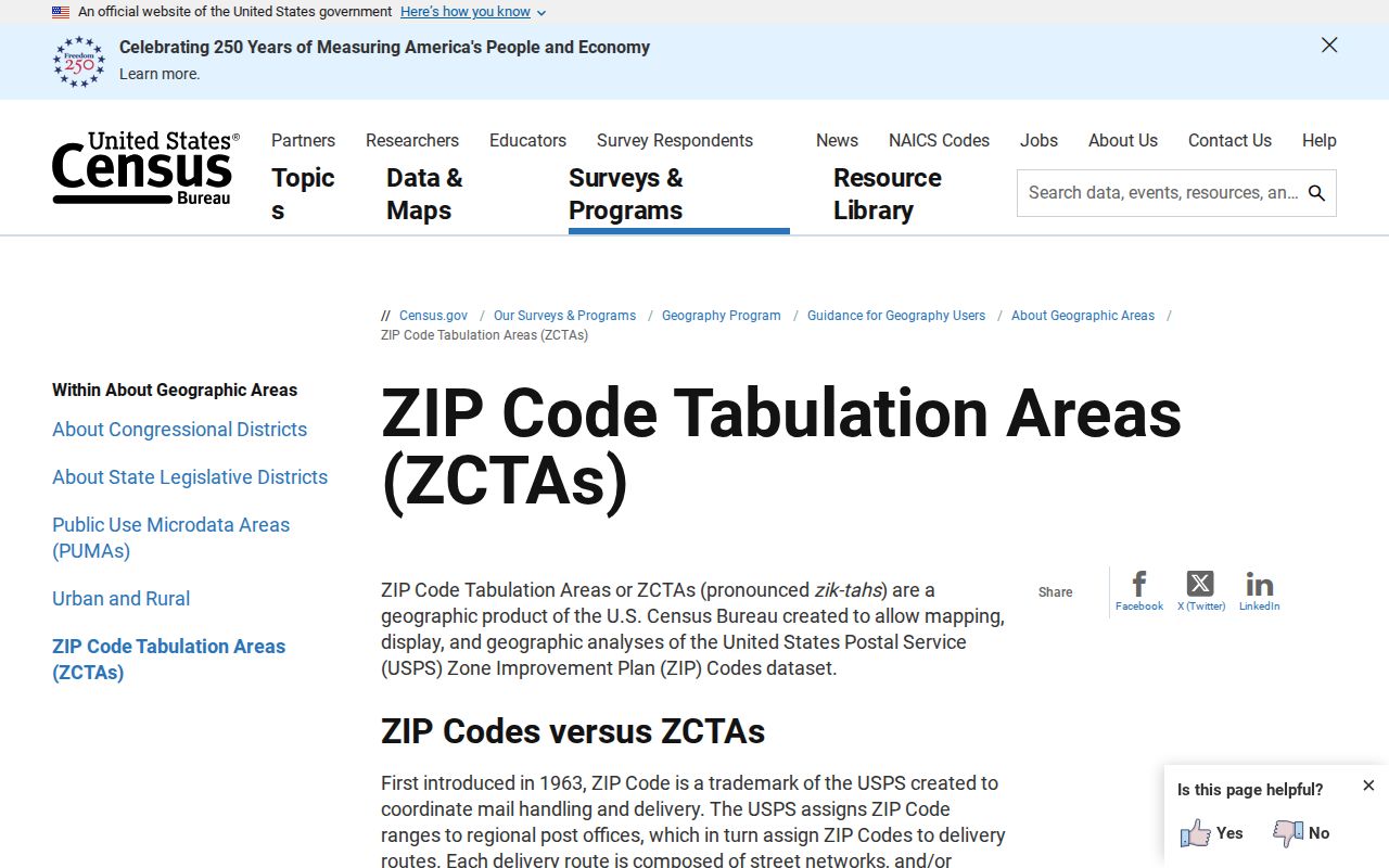
The Census explanation supports broad comparison only; USPS remains the authority for an exact delivery address.
This is an important map-reading rule. Population figures labeled for Frankfort village describe a government geography, while figures labeled for a ZCTA describe a statistical geography. Neither creates a resident list. When comparing counts, retain the geography name and source year instead of shortening both to “Frankfort ZIP.”
Frankfort ZIP and Village Limits
A mailing city, township, municipality, and county are separate facts. ZIP 60423 can appear on both Village and Township addresses, and a parcel in Frankfort Township may sit outside the incorporated Village. Current Village planning documents also discuss annexation and Will/Cook county contexts. Therefore, a Frankfort ZIP code directory should label each boundary from the office that maintains it.
- ZIP and ZIP+4
- The five-digit code identifies a delivery area; four added digits narrow a segment such as a block, building, or group of boxes.
- PO-box ZIP
- A code or segment used for post-office boxes rather than a mapped set of homes.
- Unique ZIP
- A postal code assigned to one high-volume organization. None was verified for Frankfort in the reviewed sources.
- Carrier route
- The delivery path used by a postal carrier. It can cross boundaries used by local government.
For records, the distinction directs the search. Village permits and municipal files begin with the Village. Assessment and deed work often runs through Frankfort Township and Will County. USPS remains the source for the deliverable address, and no one layer replaces the rest.
Routes Across Frankfort ZIP Geography
Shared routes help explain mixed place labels in records. The Old Plank Road Trail runs through Joliet, New Lenox, Frankfort, Matteson, Richton Park, Park Forest, and Chicago Heights. Rail and major road corridors also cross municipal lines. A newspaper, cemetery item, school record, or archive entry may use a nearby town even when the event concerns the wider Frankfort area.
Use such context as a lead, not proof. The local history chronology records Frankfort Station, the 1855 plat, and later Village incorporation. Older place names can predate today’s postal system. Match the old source to a plat, parcel, legal description, or mapped landmark before assigning it to modern 60423.
Note: Shared roads and trails explain regional references, but they do not establish a person’s address or legal municipality.
Frankfort ZIP Directory Access
Online access starts with USPS, the County SOA address tools, the Township Assessor, and county GIS. If a screen fails, use the county or township office, request a specific nonexempt record under the Illinois Freedom of Information Act, or consult library maps and plats. Voter information follows Election Code limits and is not an unrestricted ZIP-based directory.
Keep a source date with every result. Will County publishes address and street layers on a regular cycle, while parcels and municipalities have their own releases. Postal routes and annexation status can also change. A saved 60423 result is evidence of what the source showed on that date, not a permanent boundary ruling.
Record Frankfort ZIP Evidence
Save the address as entered, the standardized USPS response, five-digit ZIP, ZIP+4 when returned, parcel PIN, mailing city, legal municipality, township, county, and the date of each source. Those fields make later corrections possible. They also show exactly where a postal result ends and a government boundary finding begins.
When sources differ, do not choose the label that seems most familiar. Ask the office responsible for that field. USPS controls the postal form, County 9-1-1 maintains addresses used by the County SOA search, the assessor maintains assessment data, GIS publishes mapped layers, and the Village maintains municipal records. A deed’s legal description may be needed when street labels are not enough.
Older material adds another challenge. Frankfort Station, the 1855 plat, railroad routes, and Village incorporation belong to eras before modern ZIP codes. Never assign 60423 backward to a nineteenth-century source. Cite the historical place name exactly, map it with plats and land records, and use the ZIP only for the present address.
Limits of a Frankfort ZIP Directory
A ZIP search cannot show every person who lives in an area. Parcel services describe land; assessment records describe administrative roles; voter lookup confirms one registration when the required personal facts are supplied. Current vital records and protected addresses follow separate access rules. None becomes an open household list just because it contains a ZIP field.
Use 60423 to narrow a known address or known-person search. Stop when the result answers the lawful question. If a record appears wrong, seek correction from its custodian rather than copying the mismatch into another list. That preserves the value of the Frankfort ZIP code directory while respecting the limits built into each source.